Tuesday
Sep132016

Delivering drone inspections to the insurance industry

Understanding the full extent of damage to infrastructure after incident like a storm or fire is a hugely important — and valuable — service.

So how would you go about it?

You could send some people in (once all the hazards are removed) to manually document the damage, renting equipment like cherry pickers and scissor lifts, and then collating all that data to build a full picture.

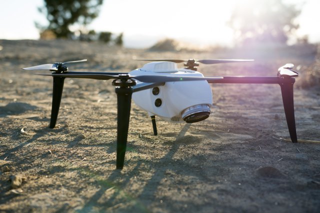
Or you could get some smart, flying robots to do it for you.

Using drones to provide aerial inspection services to the building and insurance industry.

Water tank inspection using DJI drone

Many have gotten very good at it. They regularly deliver huge amounts of drone data to their clients — comprehensive inspection sets with important visual details.

But getting this data to their clients wasn’t as efficient as the rest of their operations — often, they relied on on USB sticks and external hard drives, using couriers or mail services .

It was time for a change allowing Cloud-based processing and delivery. 

Large insurance events — such as storms — require a rapid response. Services dispatch their pilots with minimal notice, and they need the captured imagery to be available for analysis as soon as possible.

Insurers want a tool that could not only process inspections quickly online, but could produce them according to their specific outputs and formats.

High-quality visualizations with client and user access

With a growing client base across the building and insurance industries, service providers understand that ease of use makes their clients more likely to engage with the data.

A new way of working — with Propeller

Propeller can start delivering inspections to their clients online.

Water tank inspection delivered via Propeller platform

They set up a simple and reliable workflow that means their clients get easy-to-understand inspection sets quickly after an insurance event or risk assessment:

  1. Users deploy pilots from their network
  2. The pilot uploads their data securely through the cloud to Propeller for processing
  3. Propeller produces outputs and formats according to specification within 8 hours
  4. Clients can view and analyze their inspections through an online portal

Annotation tool helps you mark areas for further assessment and repairing

This straightforward workflow helps users increase their efficiency and ultimately competitiveness — in a time-sensitive industry. Four months after signing up with Propeller, one customer had this to say:

“We love working with Propeller, who continue to build a fantastic product and provide a world-class service. The challenge of helping our clients understand the immense opportunity drone technology affords is complicated, but Propeller simplifies this process and helps us bring our clients along on what is ultimately a transformational time for their industries as they begin to embrace the possibilities.”

An inspection tool that delivers on drone potential

Drones provide a safer and more efficient alternative to manned asset inspections, with rapid uptake in insurance and other industries.

Propeller’s inspection tool is delivering this data, allowing users to:

  • Inspect in 3D, zooming in with high resolution on areas of interest
  • Make annotations and export them alongside reference images as a PDF report
  • Easily switch to view full resolution stills

A part of PDF report generated from water tank inspection set

Used alongside Propeller’s cloud software for processing and hosting drone flight images, they help to deliver quality inspections quickly and easily.

Tuesday
Sep132016

DJI and Propeller Aero bring turnkey solutions to construction and mining industries

August 3, 2016 — DJI, the world’s leading aerial-imaging company, has partnered with leading UAV software company Propeller Aero, to launch an integrated solution to reduce costs, improve safety and drive operational efficiency in the construction and mining industries.

The partnership integrates DJI’s market-leading commercial-grade aerial platform, the Matrice 100 with Propeller’s cloud-based software specifically designed for surveying and inspection. This easy-to-use, fully-integrated solution will provide enterprises and commercial UAV operators a simplified, quick and efficient way to automate operations and access data. The solution will enable businesses to accurately perform do site measurements, volumetrics and share data seamlessly with just a few clicks.

“It’s great to see innovation around DJI’s aerial technologies and how these ideas are turning into actual business opportunities and practical use cases,” said Michael Perry, DJI’s Director of Strategic Partnerships. “Deploying UAVs for surveying and inspection can significantly reduce costs, minimize workplace hazards and realize fundamental operational improvements especially for businesses that operate in quarries, construction sites and asset infrastructure. Being from Australia, Propeller Aero has had the considerable advantage of developing alongside the industries that have been using commercial UAVs since 2002; the platform is already integrating drone data into the existing work flows and processes that businesses are using.”

The Matrice 100 platform has all of DJI’s easy-to-fly technology built in, including the flight controller, propulsion system, GPS, DJI Lightbridge, a dedicated remote controller, and a rechargeable battery. This system automatically manages the most complex tasks required for flight, so businesses and companies can focus on getting the job done. Propeller Aero’s online platform offers industry-leading capabilities for geospatial data processing, analytics and collaboration, including instant volumetric calculations and the ability to track changes over time. It has seen rapid adoption by commercial drone operators and enterprise clients in over 60 countries.

“We’re thrilled to provide an end-to-end solution for the industrial sector together with DJI,” said Rory San Miguel, Propeller Aero’s Co-Founder and Co-CEO. “As the market leader in UAV hardware, DJI is making its technologies more reliable and easy to use for operators, and at the same time, actively responding to the needs of commercial enterprises. This partnership is a natural step for us, and we’re looking forward to bringing this solution to the mining, construction, and asset industries, and those who are ready to embrace this technology.”

Check out partnership details and register your interest at:https://www.propelleraero.com/dji

Tuesday
Sep132016

New, Improved Kespry Drone 2.0

Kespry_Drone_2.0Kespry, which designs automated drone systems for commercial use, has announced the new Kespry Drone 2.0. The new lighter-weight drone flies 2X as long, covers 2X the ground area, and has 2X the wind resilience, due to the new airframe, battery, and flight system improvements.Based on requests from commercial customers, the new Kespry Drone 2.0 now flies over 30 minutes per flight, covering up to 150 acres at a 400 foot altitude, and can operate effectively in up to 25 mph sustained winds and 35 mph wind gusts.

“With the lighter and faster Kespry Drone 2.0, Lehigh Hanson sites will be able to map larger areas faster,” said Mike Moy at Lehigh Hanson. “The expanded ground coverage and obstacle avoidance will allow the plants to more effectively manage their inventories, safely assess mine pits, and help control costs.”

The new Kespry Drone 2.0 weighs under 2 kilograms, which puts it in the “Micro UAV” category for streamlined regulatory compliance around the world.

Kespry delivers a fully-automated drone system, which takes off, flies the designated flight path, and lands, all without operator intervention or even a joystick. To help customers operating in congested areas, including applications like roof inspections for insurance claims, the new Kespry Drone 2.0 is the first automated drone system that includes an on-board LiDAR sensor that automatically detects and avoids obstacles like trees, cranes, and buildings.

The new Kespry Drone 2.0 also has a lighter-weight and customized Sony industrial camera that captures more geospatial data for detailed 3D models that assist companies in areas like mine planning, operations, inspection and safety.

“We’ve seen increased demand from technology partners like Kespry in the drone and robotics markets,” commented John Monti, director of visual imaging solutions at Sony Electronics. “The new lightweight Sony UMC-R10C is designed specifically for industrial applications leveraging low weight while maintaining high-quality image capture.”

The Kespry Drone 2.0 continues to be the only fully automated and integrated commercial drone system that’s easy for companies to deploy at scale. The Kespry Drone, Kespry App, and Kespry Cloud reporting systems all work together seamlessly, so companies can quickly collect and analyze valuable aerial intelligence.

Source: Press Release

Tuesday
Sep132016

AeroPoints – Hardware for Accurate Drone Surveying

Australian technology company Propeller Aero has announced the launch of AeroPoints: smart ground control points that makes it easy for anyone to capture survey-accurate mapping using drones.


AeroPoints’ patent-pending technology provides a simple solution to one of the major roadblocks to widespread commercial drone adoption: accuracy. It’s another step forward for Propeller Aero on its mission to transform the way different industries can use drones and other camera devices.

“Drones can fly over a site and capture incredibly valuable data for surveyors and engineers in just minutes. But if you want accurate data, you need to spend hours on site creating ground control points before the drone flight. These calibration points are critical for a reliable results, but they add a significant amount of time, labour and expense,’” said Rory San Miguel, Propeller’s co-founder and co-CEO.  “Now there is a simple solution: AeroPoints make the calibration points their own smart device.”

Typical ground control requires establishing precise geolocation position using expensive surveying equipment, and then securing a visible ground marker exactly on the pre-marked GPS point. AeroPoints are portable ground control markers, visible from the air and capable of quickly capturing its own position down to 2cm absolute accuracy.

AeroPoints work with any camera or drone, and integrate seamlessly with Propeller’s industry-leading cloud-based data platform and processing engine. They’re solar-powered, durable and weather-resistant, and they don’t require any on-site connection.

To use AeroPoints, customers simply lay them down, fly their drone, and then pick them up again. They’ll automatically connect to a wireless or mobile hotspot when back in range to upload captured positional data – and precision geo-referencing is done.

“Propeller’s mission has always been to help our customers process, use and share the highest quality drone data,” said Francis Vierboom, co-founder and co-CEO of Propeller Aero. “We’re thrilled to be delivering a product that will make capturing that data easier and more affordable than ever for companies across the industrial sector – including mining, construction, quarries and landfills – the reception for AeroPoints has been overwhelmingly positive.”

“We pride ourselves on delivering the most accurate solutions to our customers,” said Gavin Docherty, the UAS Product Manager at Position Partners Pty Ltd. “The AeroPoints have exceeded all expectation for delivering repeatable and precise data. This is a genuinely transformational technology.”

 AeroPoints key features include:

●       Wireless connectivity to upload position information

●       Survey grade accuracy from in-build PPK for precision coordinates

●       One button operation: capture and send position information with the touch of a button

●       Ultimate durability – solar powered, waterproof and weather resistant

 Source: Press Release 

Thursday
Sep082016

Transitioning Quadcopter from Germany

quantum-0719

The Quantum TRON commercial drone takes off and lands as a typical quad-copter. In the air though the drone converts into an airplane with two propeller engines.

 The concept of transforming drones is not new. Google works on Project Wing, NASA has developed this weird 10 engine drone and the Krossblade SkyProwler. German startup Quantum Systems has taken the idea seen in prototypes to a commercial product. The video below shows how the transition from quad-copter to airplane works mid-air. The towers holding the propellers turn horizontal and the rear propeller folds up.


With 3.5m, this converting drone has an impressive wingspan. Top speed in airplane mode is 80km/h (50mph). While there are commercial drones with comparable speeds, the Quantum TRON drone needs much less energy to fly.

The batteries last for a 160km (100miles) range. Depending on speed, the batteries are good for 70 to 120 minutes flight time. The maximum payload in the 1,750 x 320 x 390mm transport box is 2.5kg (5.5lbs).

p1020010Quantum Systems focuses on precision farming, inspection and topological mapping applications. The company just made 2nd place at a drone competition in Dubai for precision farming capabilities.

Source:  I4U


Page 1 ... 5 6 7 8 9 ... 27 Next 5 Entries »