Monday
Sep262016

How Drone Usage Will Revolutionize America's Infrastructure

Uav Drone Inspecting A Cellular Communications Array

IMAGE SOURCE: GETTY IMAGES.


It's a $45.2 billion opportunity.

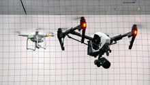
While commercial drones have been flying since the early 1980s, their importance to commerce is just starting to take off. According to a recent report (link opens PDF) by business consultancy PricewaterhouseCoopers (PwC), the potential commercial applications for drones is astounding. It found that the global value of drone-powered solutions is $127.3 billion, with the best prospect for drone applications being the infrastructure sector, which PwC pegs at a $45.2 billion opportunity.

Drilling down into the infrastructure opportunity

The reason PwC sees a vast opportunity for drones in the infrastructure sector is that these companies not only perform hazardous work but operate complex assets distributed over large areas. It cites energy companies as one sector that should be one of the first big beneficiaries of drone technology solutions. That's because drones can increase safety and save money by performing three critical applications: investment monitoring, maintenance, and asset inventory. Several companies have already used drones for these applications, and given the initial results, drone usage is likely to continue to become an increasingly important tool for American infrastructure companies.

Drones in flight: Saving lives, time, and money

Drones have already taken flight in the oil and gas sector with ConocoPhillips (NYSE:COP)making history in 2013 after it was the first company approved by the U.S. for the commercial use of a drone. That initial flight took place in remote airspace over the Chukchi Sea in Alaska with a ScanEagle drone manufactured by a subsidiary of Boeing (NYSE:BA). ConocoPhillips used the drone for marine mammal and ice surveys offshore Alaska as it prepared to conduct exploratory drilling in the region. While the company never moved forward with this particular drilling project, drones are becoming an increasingly important tool for oil and gas companies.

Not only are oil companies using drones to gather data for exploration, but they are using them for inspection operations to determine which drilling rigs need maintenance. For example, producers BP (NYSE:BP)Shell (NYSE: RDS-A) (NYSE: RDS-B), and Apache(NYSE: APA) are using drones to inspect offshore oil rigs in the North Sea for damage. In this case, drones equipped with high-definition and thermal cameras are replacing workers that needed to hang from a wire to inspect rigs. This replacement not only improves safety but it can save time and money, which is critical given where oil prices are these days.

The oil industry is not the only one employing drones for safety reasons. Telecom giant AT&T(NYSE:T) recently completed a trial using drones to inspect its cell towers. It did so because "every time we use a drone it's just one less tower climb. Every tower climb that we can save provides a safer situation, or less opportunity for potential injury." AT&T hailed the trial as a success and going forward it plans to use drones in its tower operations to inspect them for trouble spots. While the drones will not replace tower climbers, it will enable the company to use them more efficiently because they will not have to climb every tower, and when they do, they will know what to expect and will have the proper equipment with them.

Uas

IMAGE SOURCE: AEROVIRONMENT. 

Cashing in on the drone revolution

Most of the companies that operate drones serving the infrastructure sector are privately held, which limits investment options. Furthermore, several drone makers are embedded in larger companies like Boeing and are therefore a small piece of their global business, which limits investors' direct upside. That said, investors do have at one compelling option to consider.

AeroVironment (NASDAQ:AVAV) is an early leader in the unmanned aircraft space after spending decades developing solutions for the military. It is initially branching into commercial applications to change the way farmers and energy providers monitor and manage their assets. AeroVironment has developed a turnkey information solution, with its Puma AE its first commercial drone approved by the Federal Aviation Administration. That drone is already in the field with British oil giant BP, which currently uses it to monitor operations at its Prudhoe Bay oil field in Alaska. That said, commercial drone applications are a small part of AeroVironment's current sales, though it represents a massive opportunity for the company over the long term.   

Investor takeaway

Drones are just starting to take flight to provide time- and money-saving solutions to infrastructure companies. While that is good news for investors in companies that own large infrastructure portfolios like BP or AT&T, there aren't many worthwhile direct drone investment options out there right now other than AeroVironment. That said, new investment opportunities should arise down the road as more infrastructure operators start employing drones.

BY Matthew DiLallo (TMFmd19)

Monday
Sep262016

UPS Uses Drone to Deliver Package to Boston-Area Island

A drone made by CyPhy Works carried a UPS package on Children's Island off the coast of Beverly, Mass., on Thursday.PHOTO:REUTERS/BRIAN SNYDER

Thursday’s delivery of an inhaler was done in partnership with drone maker CyPhy Works

United Parcel Service Inc. said Friday it successfully used a drone to deliver medicine to an island near Boston, jumping into a race with competitors such as Amazon.com Inc. to test drone delivery inside the U.S.

The delivery of an inhaler on Thursday was conducted in partnership with CyPhy Works, a drone maker in which UPS holds a stake. The delivery kicks off a wider test by UPS of using drones for commercial deliveries to remote or difficult-to-access areas.

“UPS has a history of trying to take a look at new technologies as they evolve,” said Chuck Holland, a vice president of industrial engineering. “We’re looking at this in steps,” he added, declining to say whether the company may someday use drones more broadly.

UPS’s delivery marks the first major commercial delivery conducted via drone in the U.S. since the Federal Aviation Administration implemented long-awaited rules in late Augustauthorizing businesses to start using small drones. The company previously has tested drone use for indoor warehouses and international disaster or human-aid relief, which aren’t subject to the same regulations. UPS is on the FAA’s drone advisory committee.

“Now we can conduct commercial operations without having to go through the rigmarole of getting an exemption from the FAA,” said Helen Greiner, co-founder and chief technologist of CyPhy Works, the Boston-area drone startup that operated the drone. UPS invested an undisclosed sum in CyPhy last year via its strategic enterprise fund.

UPS joins a crowded field of companies including Amazon and Google parent Alphabet Inc. eager to deploy drone technology. Amazon unveiled its plans to deliver via drone in late 2013 and has lobbied for faster action from regulators. It made a deal with British authorities in July to begin testing deliveries in the U.K., where drone regulations are seen as less stringent as in the U.S.

Alphabet, meanwhile, said in early September that it plans to use drones to deliver burritos at Virginia Tech in a test of its technology. Deutsche Post AG’s DHL also has tested delivery by drones, including medicine to a German island in the North Sea.

Traditional delivery companies generally have expressed more skepticism about the likelihood of package delivery via drones. “There are two enormous transportation networks that are built around moving light packages and freight, and they are FedEx and UPS,” FedEx Corp. Chief Executive Fred Smith said after Amazon’s 2013 announcement.  

UPS’s brown and white drone, which was emblazoned with its logo, took off from Beverly, Mass., carrying the 2-pound package. It flew 3 miles over water within line of sight to a nearby island, touching down in a patch of grass. The drone flew autonomously, without a human pilot, simulating an urgent medical delivery.

One incentive for UPS to invest in drone technology is that the company has higher labor costs than rival FedEx due to its unionized drivers, package sorters and other workers. Still, any wider scale use of unmanned technology to do those jobs likely would complicate the delivery giant’s relationship with the Teamsters labor union.

By  LAURA STEVENS and GEORGIA WELLS for the Wall Street Journal

Tuesday
Sep202016

Why it’s time to start developing a drone security strategy

drones apocolypse

Credit: Thinkstock images

In the wrong hands, drones can be life-threatening

Everyone is familiar with the military use of drones. You’ve probably heard about Amazon’s plans to deliver commercial goods to consumers via drones. And Google is reportedly developing solar-powered drones that will deliver high-speed Internet.

151117 drones 2

Drones

There’s no limit to the beneficial uses of drone technology. Dropping Zika-fighting pesticides or firefighting chemicals in remote areas. Search and rescue. Delivering emergency medical supplies. The list goes on and on.

But what about the darker side of drones? Is it time for security pros to begin formulating a drone defense strategy?

Consider this: An unmanned aerial vehicle (UAV) dropped a package with 144.5 grams of tobacco, 65.4 grams of marijuana, and 6.6 grams of heroin into the north yard of the Mansfield Correctional Institution in Mansfield, Ohio, causing a prison yard melee.

Or how about the British burglars using drones to check out which houses to rob. Or theNew Jersey bandits who used a drone as a lookout in case the cops showed up.

Enterprise security concerns 

It’s probably just a matter of time before drones become part of the toolkit of hackers, spies, industrial thieves, disgruntled employees, etc.

Joerg Lamprecht, co-founder and CEO of Dedrone, a German company headquartered in San Francisco that makes early-warning and detection systems for drones, says, "When your airspace is exposed, no longer are fences, video cameras, and security guards adequate to protect sensitive buildings or personnel.”

According to Lamprecht, drones that can carry up to five kilograms and fly several kilometers can be purchased on the Internet or at any local electrical goods store for less than $1,600. And, by using a GPS and autopilot, many drones can fly a programmed route, which means an attacker can be in a completely different location from the crime scene, he says.

+ MORE ON DRONES: Infographic: Commercial drones by the numbers +

Imagine a camera-equipped drone hovering outside the window of a top researcher or product developer or CEO for a major company, taking snapshots of documents or pictures of a whiteboard or even screengrabs. In fact, with a high-powered lens, the drone could be sitting atop the building across the street.

Then there’s the whole issue of wardriving, but now it’s warflying. Gartner analyst Gerald Van Hoy says drones can cruise over neighborhoods and search for open Wi-Fi connections in order to gain access to an individual's computer, network, and even use their IP addresses for illegal activity like identity theft.

"The same goes for businesses," Van Hoy says. "Recently, there was a case in the news about a drone that gained access to a corporate network because the devices on the higher floors of the building were not encrypted."

Drone-maggdon scenarios

Beyond just industrial sabotage, drones could have a disastrous impact on public safety.

"The threat potential of drones is diverse," says Lamprecht. "Unmanned aerial vehicles (UAVs) also pose a severe threat to the safety of airplanes." The FAA receives more than 100 reports of drone sightings each month. And earlier this year, independent research institutes warned of the danger of terrorists abusing consumer drones for attacks on aircraft.

"In fact, the FAA has restricted drone use within five miles of airports for safety reasons. If a drone were to accidentally get sucked up by a jet engine, the engine would explode and the plane would crash," adds Jack Reis, project manager at Harbor Research.

When wildfires were burning up Northern California last summer, aircraft carrying water and fire retardant were hindered by private citizens sending up drones to get a better look at the situation. Firefighters on the ground and the aerial flight crews have no way to communicate with these drone operators.

Reis says the possible threat of an explosive device or hazardous biochemical mechanism attached to a drone aimed at harming civilians is another frightening scenario. In April 2015, a UAV carrying radioactive material landed on the Japanese Prime Minister’s roof. If drones can airdrop drugs into prisons, they can also drop bombs, chemicals, or a deadly virus into a city's population or a town's water supply.

Another scenario is that a drone can mess with your smart home, tamper with the electricity, turn on the gas, turn off the heat, turn the water on until it floods the entire house. And could a drone attack a smart neighborhood or even a smart city?

"More importantly," adds Reis, "Hackers can use drones to affect remote devices coming online in applications such as power plants/transmissions, pipelines, and other mission-critical-distributed devices that may not have proper security standards. In addition to disrupting the process that is occurring around that device, an open entry point could lead to a network of devices extending from a pipeline; for example, all the way to a process plant or transfer station."

"Don’t get me wrong," adds Van Hoy, "Drones are just the current flavor of the month, this kind of threat could also come in the form of driverless cars, or a robotic window cleaner, or any other number of Internet of Things (IoT) connected devices. I’m not saying the risks outweigh the benefits of these kinds of technologies, just that security should always be a high priority."

On the plus side

"In spite of the safety and security issues, we believe the drone market shows tremendous opportunity," Reis adds. "As end-customer needs are clarified, so too will the value propositions offered by drone manufacturers in innovative use cases. Currently, aerial surveying, mining, oil and gas, and agriculture markets are benefitting heavily from the use of drones."

For example, agricultural use includes spraying large tracts of land for pests, and trials for minimizing the mosquito problem/Zika virus threat are in process for high risk states such as Louisiana and Florida. Drones help farmers better manage their crops by providing aerial views of everything from irrigation problems to soil variation to pest and fungal infestations.

"Drones can get into tight spots and use less product through precision applications," says Hammond. "And it’s especially practical when dispersal is combined with refined sensor data such as heat and insect pressure."

+ MORE DRONES: Commercial drones gaining altitude with enterprise IT vendors +

In addition, Hammond says that live video feeds from hard-to-reach places are one of the real benefits of drones because these devices are more flexible and can move in closer than a helicopter, for example, to view small areas such as cracks in a bridge’s superstructure. Last year, Somerville, Mass., used drones to survey the roofs of government buildings to evaluate excessive snow loads and then to direct the city's removal plan. Drones can also survey traffic jams, automobile accidents, ice and snow conditions on roads and bridges, and calculate the number of cars in a parking lot.

According to Forrester, all types of sensors can attach to drones that collect information such as optical, thermal, chemical, infrared, etc. Chemical sensors can detect methane in gas fields and thermal sensors can detect the presence of humans or animals in dangerous areas such as those in proximity to geysers, mudpots, steamvents, hot springs, or volcanoes. Drones can also deliver supplies and medicines to secluded areas, contagious zones, and remote towns and villages that are inaccessible by any means except by foot.

Drone detection

According to Reis, drones are the ultimate remote device—some with ranges of hundreds of miles and most include video cameras to see what's going on the entire time. While these capabilities enable a wide range of value-added applications across many industries (precision agriculture, power transmission line inspection, pipeline inspection, package delivery, etc.) they also present significant safety and security risks.

"The best protection against hostile drones is a comprehensive, automated system that consists of dependable drone detection and integrated countermeasures that are triggered based on the individual threat situation and legal preconditions," says Lamprecht. "Our DroneTracker reliably detects and identifies criminal drones by means of multiple sensors, data fusion, and intelligent software technology. Defensive measures can be activated automatically and security services notified."

Tuesday
Sep202016

UAV Photogrammetry Predicts Infrastructure Issues

aqua-romagna-3d-mesh-contextcapture-01Inspecting infrastructure assets like bridges and dams is crucial to their maintenance, but it’s easier said than done. Since these structures are large, complex, and often out of the way, traditional methods like terrestrial LiDAR can be slow, expensive, and difficult to use.

Romagna Aqua, which is responsible for the drinking-water infrastructure in the Emilia-Romagna region of Italy, ran into this problem and solved it. The company needed a better way to inspect and maintain the backbone of their region’s aqueduct, the Ridracoli Dam. They found what they were looking for in UAVs and photogrammetry.

Using these technologies, the company was able to survey the dam at an accuracy that compares favorably to terrestrial LiDAR, but with greater coverage, at a much lower cost, and with much less effort.

And that enables them to do a lot more in terms of maintenance. Now that they can use UAVs and photogrammetry to survey the dam continuously, they are able to use preventative maintenance techniques and repair the dam before it breaks, saving money and lives in the process.

This is how they got there.

A dense point cloud of the dam

A dense point cloud of the dam

A Better Way to Maintain the Ridracoli Dam

The Ridracoli Dam has a basin covering 32 million cubic meters. The structure is 108 meters (355 feet) tall at the base and 440 meters (1444 feet) tall at the crest. It is comprised of 600,000 square meters (or 2 million feet) of concrete. It’s big.

The dam is also crucial to the drinking water of 48 municipalities, so Romagna Aqua maintains it with very high safety standards. Because of this, the company has developed a model for predicting how the dam will respond to changes in environmental conditions, especially earthquakes and thermal variations. Knowing about a problem ahead of time means being able to prevent it.

There’s one catch: To feed this model, they need accurate data that can be gathered with short turnaround times. Romagna Aqua thought that UAV photography would suit their needs in terms of speed, but they needed to be sure it fit the precision and accuracy requirements.

Does Drone Photogrammetry Make the Grade?

Working with Italdron, the University of Perugia, and the Department of Civil and Environmental Engineering, the company set up an experiment to try it out.

First they performed a topographical survey that they could use to validate the product of the UAV survey. With Total Station, GPS, terrestrial laser scanners, and aerial photography, they surveyed the main dam, as well as ancillary structures such as the guard house and the weighting blocks in the abutment.

Next, Romagna Aqua set up their UAV survey. They planned the UAV flights for a single day to minimize the effect of atmospheric conditions (like lighting and weather) on the data. Before beginning the survey, they used Total Stations to place control points around the dam and surrounding area to geolocate the results of the UAV photogrammetry.

By sending the UAV out for 23 flights, each lasting about 25 minutes, they were able to gather upwards of 6,000 photographs. Some of these photographs were even taken in areas that were previously inaccessible for survey, like the downstream portion of the dam’s arch.

A 3D mesh of the dam produced by ContextCapture (the left side is coloured and textured, the right side is raw)

A 3D mesh of the dam produced by ContextCapture (the left side is coloured and textured, the right side is raw)

The Model and the Moment of Truth

The group processed these photographs using Bentley’s ContextCapture photogrammetry software, which uses structure from motion (SfM) algorithms to automatically reconstruct the geometry of the dam. Bentley’s software generated both reality mesh files (3D models consisting of colorized and texturized polygons) and dense point clouds.

Romagna Aqua and their partners checked the ContextCapture 3D mesh and dense point cloud by comparing them to the traditional survey data gathered with total station, GPS, laser scanners, and aerial survey.

The results? The UAV data exceeded their expectations, showing deviations within a range of 2 centimeters and sometimes even less than a centimeter.

Solving Problems Before They Become Problems

The dense point cloud generated by ContextCapture is a good reflection of the reality. It presents a fast and inexpensive means for seeing the current state of the dam. Properly calibrated using control points, it has even more power: The point cloud can feed Romagna Aqua’s model that predicts changes in the dam’s mechanical properties over time.

By using UAVs and photogrammetry, Romagna Aqua can now perform proactive asset management. They can apply tools and methodologies that detect trends and problems before they become real-world safety risks. The company can now plan appropriate action early on, with a full view to budget requirements.

In other words, they can solve problems before they become problems—and save a lot of lives and money in the process.

Source: Spar 3D

Monday
Sep192016

Octopus ISR Systems Unveils Moving Target Indicator

Octopus ISR Systems, a developer of advanced imaging and communications equipment for various UAV platforms, presented their latest innovation in micro gimbal technology, the Moving Target Indicator (MTI).

Previously unavailable on any micro gimbal, the MTI feature is now available in the Epsilon range of micro gimbals providing advanced moving target detection capabilities for multiple targets. An ultra-powerful onboard processor analyzes incoming video in real time and relays full-frame-rate video to a ground control station, automatically alerting the operator to any moving target in the field of view.

Page 1 ... 3 4 5 6 7 ... 27 Next 5 Entries »