Monday
Sep192016

Are drones actually a sector or just another layer in the enterprise SaaS stack?


The world is abuzz — the past several years have been an exciting time for drones. From videos of drones flying cool missions inside R&D labs to marketing shots like Amazon’s Prime Air, drones have gained the attention of consumers, enterprises and governments.

Their ability to shoot remarkable photography and capture data, and potentially violate privacy and property rights, has led to a flurry of opinions, regulations and oversight. As a result, the landscape has become very cloudy, and we are increasingly asking ourselves if drones are actually a “sector” or yet another layer in the Enterprise SaaS stack?

Hardware and software services have dominated drone investing to date — AngelList cites $1.9 billion. Infrastructure technology and investment have lagged, yet will be essential to support more advanced service providers and to enable true autonomous delivery over longer ranges to the consumer. This is creating a refreshed demand on the innovator side as early entrepreneurs (appropriately) jumped straight to providing enterprise and consumer solutions as the industry exploded.

This, then, left a gap on the front end of the technology innovation curve that we believe now requires a Drone 2.0 refresh — technology building that will continue to support the key solution providers in expanding areas and thus perpetuate the cycle. We are seeing this with emerging enabling technology companies such as Iris AutomationPreNav and Dronesmith, among others, and believe there is room to run. Technical solutions around fleet management, smart routing, sensors and other technology aspects of the flying robots will take center stage again.

To date, the majority of enterprise drone investment opportunities have been focused around a key solution provider. These opportunities often look like consulting practices that leverage a drone to sell a specific service to an enterprise, and are meaningful solutions for many industries, including construction, mining, insurance, forestry, police and government, among others.

Indeed, each business has a viable place in both the drone “stack” and the targeted business vertical. However, the landscape is becoming increasingly fragmented and crowded, and thus difficult to see where outsized value lies for investors in order to achieve venture scale returns.

As such, we assess the drone sector through the lens of a hub and spoke model. At the center is the key solution provider, whose size is variable due to various factors. Many of the supporting functions are outsourced to vertical specialists, and connected (and disconnected) to each other at various times… akin to a living ecosystem.

Enterprise successes — the stack and platform effects

The enterprise successes so far have largely benefited from first-mover advantage, and now face increasing competition from new entrants providing incrementally better solutions at slightly lower prices. We expect that solution providers will now defend their early customers through expanding their value propositions and outsourcing non-critical drone functions, including hardware, to the lowest bidder.

Technologies or business models need a place in the stack. Hardware and software startups have grabbed market share as the drone stack has emerged. It is important to note, as certain players broaden their reach up and down the drone stack, a true technological or business breakthrough must provide a step-function improvement over the status quo. An increasing number of these solutions are being absorbed by adjacent players, as developing it themselves is trivial. Deeper tech is harder to plug-and-play, due to the tight integration required, than the component companies will indicate to a prospective investor.

Platform effect. Not only must a solution provider provide a core solution or service, it must solidify its place in the drone tech stack. This requires other technology (hardware, middleware and software providers) to build on all sides of the solution, and a structure where each additional client brings more value to the platform.

Businesses that truly enable delivery or sharpen data collection and sensing will win mindshare.

For example, Dronesmith’s sensor management platform also allows for developers to continually develop and deploy sensing applications useful to customers. Skyward has become a resource for enterprises and service contractors to manage and expand their drone operations. Iris Automation, Skydio and others are tackling the biggest challenge facing the industrial drone industry: autonomous flight beyond the line of sight. It is an industry-wide belief that industrial drones cannot take off unless they become truly autonomous, requiring situational awareness and collision avoidance technology, the latter of which Iris offers.

As the industry evolves, the key solution providers holding technological and business advantage will succeed, especially those showing platform effects. They will continually strengthen their core position and outsource the commoditized aspects of drone technology (hardware) or business (drone connectivity). Skycatch built out many of these parts as the industry sprouted, and is now servicing the largest elements of the hub as the industry has matured around industrial applications. In the future, they will use multiple vendors to support their customers’ use cases.

Applications of the hub and spoke

The workplace is clearly evolving as drones fly into the mainstream and onto the job site. Humans are pushed further up the knowledge economy chain, making our time more efficient and lives safer. We are seeing the biggest potential impacts in mining exploration (dropping prices by 10x), agricultural surveying (increasing crop yield by 40 percent-plus), geographical mapping, building and insurance inspection, package delivery, search and rescue efforts and forestry inspection. The effectiveness of drones in these industries establishes their placement in the stack and promotes network effects and technology innovation.

Drones hold promise to be a truly enabling technology supporting a variety of crucial global industries.

Businesses that truly enable delivery or sharpen data collection and sensing will win mindshare and investment as industry players increasingly include them in budgets and workflows. PreNav is addressing fundamental changes in localization and computer vision. Zipline and Vayu are delivering on the promise of drones in rural areas. Infrastructure companies will also emerge in the next wave, enabling constant connectivity, sense and avoid or routed delivery. Marketplaces around contract work, images or other data will also expand the reach of this enabling technology.

Conclusion

Drones hold promise to be a truly enabling technology supporting a variety of crucial global industries. The drone-first solutions to problems both known and to be discovered are foundationally solid, efficient and effective. The supporting web of hardware, middleware and software is now substantially robust enough to provide significant value to certain enterprises.

 by   

Thursday
Sep152016

Drones For Good: Drones Mean Faster Search and Rescue

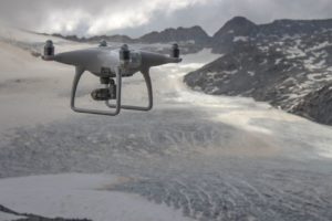
Phantom_Glacier: Image courtesy DJI

Phantom_Glacier: Image courtesy DJI

Drone manufacturer DJI is taking a leadership role in the “Drones for Good” movement – ensuring that drone technology is fully utilized for humanitarian projects.  DJI has been on the scene of major disasters across the globe, partnering with local teams to provide drone services.  They’ve partnered with other innovators to provide better technology, including their project with Ford to create drone to vehicle communications for better disaster response; and they recently awarded 100,000 to a California team who won their Developer’s Challenge for Search and Rescue.

“DJI strongly believes that drones are a force for good in the world, and we work hard to share examples of how drones are making businesses more efficient, improving educational opportunities, opening up the joy of flight and even helping save lives,” Adam Lisberg, DJI’s Corporate Communications Director, North America, tells DRONELIFE. “Any new technology raises questions and even fears for some people, so it’s important to show how legitimate concerns about drones can be managed and how the benefits of drones are being realized right now. DJI is actively researching ways to improve search and rescue, we’re working with Shapeways on a contest for new emergency response accessories, and and we have active outreach with first responders to find out how we can expand those benefits.”

Director of Education Romeo Durscher said that early studies find that a “properly-equipped” drone can find a missing person in a one-square-kilometer area within 20 minutes – more than 80 percent faster than traditional methods of search and rescue.

At a presentation at the InterDrone conference in Las Vegas today, Durscher discussed the study, performed in partnership with the European Emergency Number Association (EENA). “DJI’s research with Ireland’s Donegal Mountain Search and Rescue found that while a five-person rescue team needs two hours on average to find a victim in one square kilometer, a drone can not only find that victim in 20 minutes, but can take additional active steps to achieve a successful rescue,” says a DJI statement.

Image courtesy DJI

Image courtesy DJI

DJI is developing controlled test methodologies to continue collecting rigorous data on how drones can save lives in firefighting, search and rescue and other forms of emergency response, as well as better protect search and rescue personnel. DJI and the research and development firm Black Channel recently led a field study of drone rescue technology in extreme altitudes and weather conditions on the Adamello Glacier in Italy’s Dolomite mountains.

“I do think that the drones can improve search techniques,” said Joe Eyerman, Co-Director of Black Channel, which is dedicated to applying scientific methods to the evaluation of unmanned aircraft to medical missions including search and rescue, emergency response and data collection. “If we can resolve some of the minor challenges we had on this study, we would be able to give them to members of the search community right away and they could begin making the mountains a safer place.”

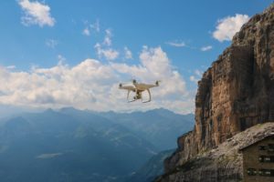
Refugio Pano Adamello: Image courtesy DJI

Refugio Pano Adamello: Image courtesy DJI

DJI says that this is the first project to use scientific methods to assess the value of drones in supporting search teams in extreme conditions.  The project used the DroneDeploy application, and created mosaic maps from the drone images to allow teams to prioritize possible victim locations, and to identify changes in environmental conditions.  But Durscher says that this is only the first step in a whole search and rescue operation:

“As we study the search and rescue process, we realize that finding a victim in rough terrain is just the first part of the process,” Durscher said. “A drone also must be able to transmit images and GPS coordinates to other searchers and commanders as part of a coordinated software solution, deliver small rescue payloads to a victim, and serve as a beacon to guide rescuers to the right spot. Drones are already being used to save lives around the world, but we believe working with experienced emergency responders is the right way to develop a strategic approach that will maximize their capabilities.”

 BY  for DroneLife

Thursday
Sep152016

InterDrone 2016: Neurala Brings Deep Learning to Drones

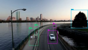
Neurala-SDK-for-Drones-Image-768x432

A Boston-based startup is launching a software development kit to boost the “intelligence” of drones with hopes of changing the way UAV companies think about AI.

Neurala announced the launch of Bots Software Development Kit at Interdrone on Thursday. The kit will allow manufacturers to install artificial-intelligence “neural” software directly into their applications without the need for additional hardware. The enhanced applications can then equip drones for “autonomous flight, object recognition, visual following and visual inspection capabilities,” according to a Neurala press release.

“We are disrupting the market.  You don’t need expensive equipment or server access to build autonomy and object recognition into a drone application,” said Neurala CEO Massimiliano Versace. “You can buy an industry standard drone components, add our software, and achieve state-of-the-art performance leveraging Deep Learning and AI in your drone out-of-the-box.”

Dubbed Brains for Bots, the new software kit will also work on several Internet-of-Things devices such as self-driving cars and robots. The company bases the Neurala Intelligence Engine on a solution it developed for NASA’s planetary exploration modules.

The company points out that several drone products claim to offer limited flight autonomy; however, those products require network assistance from a connected smart device or via cell-phone or other radio signal.

“The problem for these competitive solutions is that communications delays and reliability issues make true autonomy unusable in many situations,” a company spokesperson stated.

Neurala says Brains for Bots will allow drones to:

Remember objects, people or groups of objects. Instant training can be performed by the end user to learn a particular object or person. For more robust object categories, groups of objects can be pre-trained and, if desired, personalized by the end user.

Identify learned objects and learned object classes when it sees them anywhere in the real-time video stream. The SDK provides the label name given to the object or object class, along with a likelihood estimate.

Recognize and provide the location of learned objects or object classes when it sees them anywhere in the real-time video stream.

Track the movement of recognized objects from frame to frame in the live video stream with updated coordinates. Information can be easily converted using the supplied tools to left/right, up/down and forward/back motor commands.

Another startup, Teal Drone has already integrated Brains for Bots in a configuration that allows its models to follow people or objects using telemetry from on-board cameras.

Last year, Neurala released Selfie Dronie – a platform that eliminates the need to buy a specialized selfie drone in order to shoot hands-free video. The software uses an AI/deep-learning module that will empower Parrot Bebop and Bebop 2 drones to capture hands-free videos and follow a subject autonomously.

 BY  for DroneLife

Thursday
Sep152016

Epson and DJI Partner to Create AR Smart Glasses for Piloting UAVs

Screen Shot Epson glasses

Epson, providers of the Moverio® augmented reality (AR) smart eyewear platform, today announced a partnership with DJI, the world’s leading maker of unmanned aerial vehicles (UAVs), to create new solutions for the Epson Moverio smart glasses and DJI’s suite of products and software development kit (SDK) that enhance the safety, productivity and capabilities of UAVs for hobbyists and professionals alike.

As one of the first initiatives of the partnership, DJI will optimize the DJI GO app for the Epson Moverio BT-300 AR smart glasses, shipping late Q4.  With the app and the Moverio glasses, drone pilots will be able to see crystal clear, transparent first person views (FPV) from the drone camera while simultaneously maintaining their line of sight with their aircraft. The DJI GO app works with the DJI Phantom, Inspire and Matrice series flying platforms as well as the Osmo handheld gimbal and camera.

The two companies will co-market the Moverio BT-300 as a compatible DJI accessory. The Epson smart glasses will be available for purchase on DJI.com while the DJI GO app will be available for download from the Moverio Apps Market.

The Epson/DJI partnership arrives as newly streamlined FAA regulations for UAVs took effect last week, making it easier for businesses to expand the use of drones for a variety of aerial photography and videography purposes.  Construction, real estate, insurance, agriculture, emergency response, conservation, academic research, film and video production and numerous other fields that benefit from UAVs have embraced the relaxed rules.  However, the FAA has maintained the rule that UAVs must remain within the visual line-of-sight (VLOS) of the remote pilot, reinforcing the relevance of the Epson and DJI partnership.

“The Moverio BT-300 marks an impressive advance in performance for the platform and will make flying and filming safer and help users stay in compliance with federal regulations,” said Michael Perry, director of strategic partnerships, DJI. “We are excited to see the incredible applications that can be built with the BT-300 and the recently relaunched DJI SDK – the possibilities truly are endless.”

DJI maintains a 70 percent market share of the $2 billion consumer drone market, and its aerial platforms are used by two­-thirds of businesses approved by the FAA to operate commercially. More than 600,000 UAVs are expected to be in use in 2017. 1

“We believe this partnership with DJI will revolutionize how UAV pilots operate their aircraft in this fast-growing industry, now and into the future,” said Eric Mizufuka, product manager, New Ventures for Epson America. “In addition to validating Epson’s investment in its Moverio line, this is the first time AR smart glasses will be widely available for a mass-market consumer application, marking an historic milestone in the evolution of the category.”

In addition to making drone piloting safer, the goals of the partnership include providing pilots and film-makers with new AR tools for enhanced productivity when using a UAV.  Epson and DJI will also work together to create entirely new experiences for the fast-growing number of UAV hobbyists and businesses, as well as conduct joint sales and marketing efforts worldwide.

Launching its first-generation smart glasses in 2011, the Epson Moverio BT-300 represent the world’s lightest binocular, transparent smart glasses with an OLED display. Combining breakthrough silicon-based OLED digital display technology and Android OS 5.1, the Moverio BT-300 enables truly transparent mobile AR experiences. The Epson Moverio BT-300 will be available in late Q4 and may be pre-ordered at Epson.com/Moverio. For a complete product overview of the Moverio BT-300, please visit the following link.

BY 

Thursday
Sep152016

Drones Cut Cost of Thermographic PV Panel Inspections

skycatch- Drones could cut the cost of thermographic PV panel inspections to between €1,800 and €2,750 a day, covering two hectares an hour, Solarplaza has learned. The cost is a typical daily rate for a pilot and a sensor operator and drone inspections from a height of 15 metres yield “very accurate results,” said Benjamin Federmann, director of marketing and communications at specialist firm Aibotix.

The technique involves mounting a high-definition infrared camera on a drone and running the images through an analysis program to detect hotspots that might reveal the presence of faults. Maintenance teams can then visit these hotspot locations directly, without having to survey the entire solar field, which saves on operational costs.

According to published information, a drone can survey 4,000 panels in about five minutes, while a human inspection would take more than 8 days at a rate of one panel inspection per minute.

As well as being quicker, drones could be around half the price of ground-based inspection techniques, assuming one megawatt of panels per hectare and rates of around USD$250 (€225) per megawatt of panels for manual inspections.

Drones, or unmanned aerial vehicles (UAVs), have been used for panel inspections for the last four years but their use in some markets, such as the US, is still limited due to lack of equipment and knowledge. “It is not that tough to fly above PV panels, but it is very important to have the thermal sensor at the correct angle to the panel to get good results,” Federmann said.

Last year at least seven US utilities were known to have been granted Federal Aviation Authority approval to commercially test unmanned aerial systems, according to the Electric Power Research Institute (EPRI). In the solar industry, as well as cutting the time and cost needed for large plant inspections, drones are ideal for surveying roof-mounted systems that might be difficult or dangerous to inspect manually.

Besides being used increasingly in Europe, drone inspections are gaining in popularity across markets where there is significant pressure to reduce operations and maintenance costs.

In South Africa, for example, the Spanish firm Enertis is using drones to cut panel inspection costs by up to 40%, while reducing survey times from a month down to a week for a 75 MW plant.

Meanwhile, a white paper by the EPRI, published in 2015, noted there were significant benefits to using UAVs for solar field inspections. “These devices can currently perform a variety of PV-related tasks, including visual imaging, infrared thermography, and vegetation monitoring that have the potential to update largely manual conventional processes,” it said.

The paper noted that US developer SolarCity was using drones for rooftop array assessments, where it was able to complete up to eight inspections a day compared to four through conventional approaches.

“Despite their commercial immaturity, unmanned aircraft systems are well positioned to serve both niche and more generalized applications,” it concluded.

Source: Solar Plaza

Page 1 ... 4 5 6 7 8 ... 27 Next 5 Entries »